
Urban Heat & Tree Mapping
Explore high-resolution surface temperature data and tree canopy cover and height data for metropolitan Adelaide. Enter your address to see how hot or cool your property is and how it relates to nearby trees.
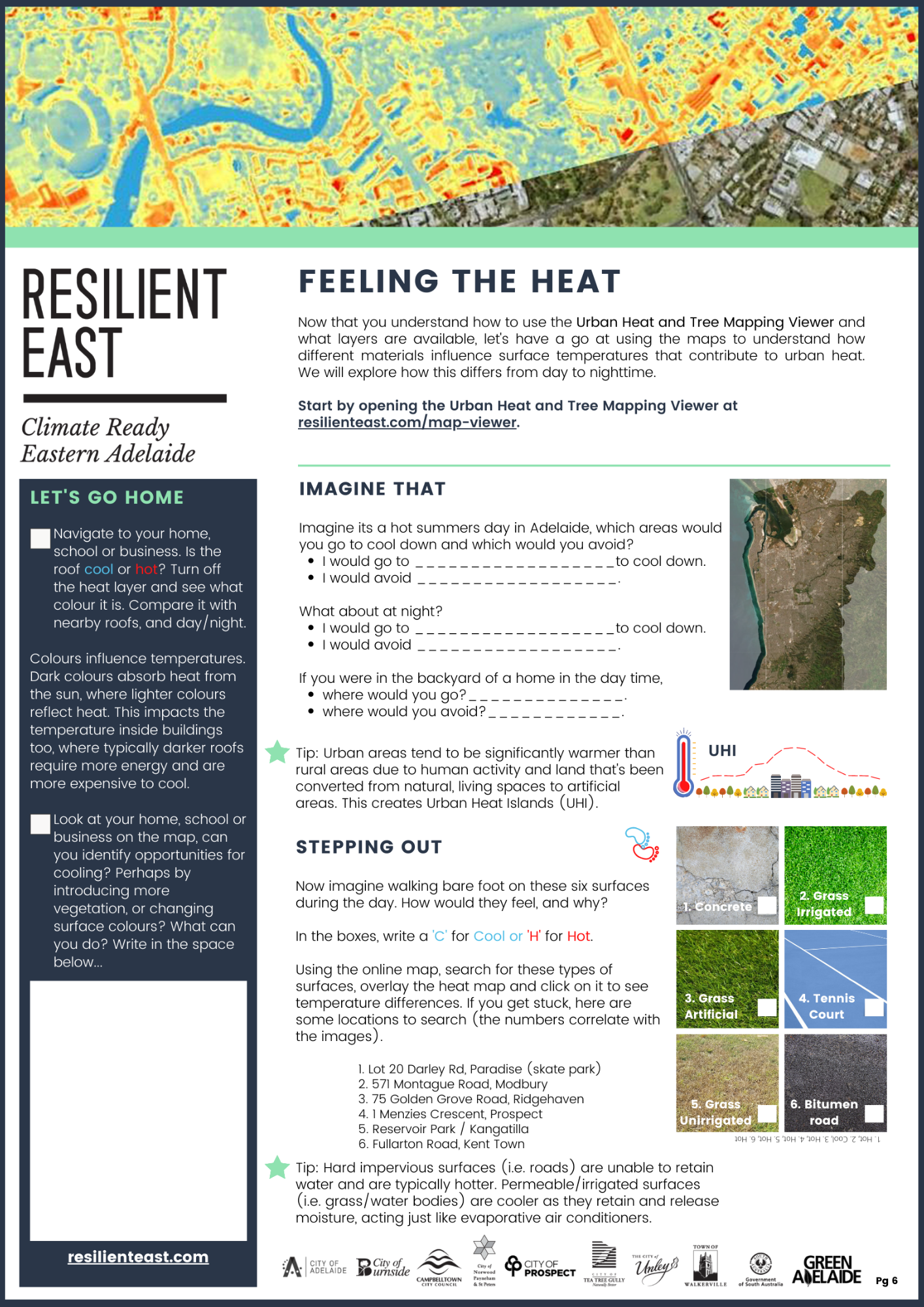
Resilient East Urban Heat Mapping Factsheets
To assist you in using the online tool, we have developed six fun and interactive Urban Heat factsheets!
They contain information and activities to help you use the online tool, understand the data and take action to cool your home, school, workplace or neighbourhood.
Download all six together using the button, or, download them individually by clicking on the images.